Victoria Maps and Orientation
(Victoria, British Columbia - BC, Canada)
The proud provincial capital of British Columbia and very much the region's number two city after
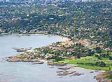
Vancouver, the city of Victoria lies at the very southerly end of Vancouver Island. The waterfront area of Victoria is both beautiful and lively, and known for its undeniable ambiance and rather English character.
Victoria is a medium-sized city, with a population of around 80,000 people within the city itself, and some 350,000 people calling the overall metropolitan area their home. The city currently enjoys an enormous tourism scene and is home to a leading Canadian cruise ship harbour, at Ogden Point.
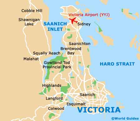
Maps and Orientation of the City
The area of Victoria that is most appealing to sightseers is actually quite small and the majority of the main sights, along with the various shops and eateries, really are within easy walking distance of the actually Old Town and Inner Harbour districts. Always especially inviting and lively is the waterfront, where you can stroll and enjoy street buskers and great views. Other prominent districts include Chinatown, Downtown, Fairfield, Fernwood, James Bay, Rockland and Rock Bay.
Maps are available at the Greater Victoria Visitors and Convention Bureau on Bastion Square, and advisable if you intend to head outside of the city and to the nearby beaches, which lie off Highway 1 and also Highway 14. However, closer to home, the Beacon Hill Park does offer an attractive pebble shoreline.
- Brentwood Bay - 21 km / 13 miles (26 minutes, north)
- Colwood - 15 km / 9 miles (25 minutes, west)
- Elk / Beaver Lake Regional Park - 13 km / 22 miles (20 minutes, north)
- Esquimalt - 5 km / 3 miles (ten minutes, west)
- Gowlland Tod Provincial Park - 20 km / 12 miles (25 minutes, north-west)
- Langford - 14 km / 9 miles (20 minutes, west)
- Oak Bay - 4 km / 2 miles (eight minutes, east)
- Saanich - 5 km / 3 miles (ten minutes, north)
- Saanichton - 21 km / 13 miles (25 minutes, north)
- Sidney - 27 km / 17 miles (35 minutes, north)
- Thetis Lake Regional Park - 10 km / 6 miles (15 minutes, north-west)
- Vancouver - 109 km / 68 miles (two hours and 45 minutes, north)
- View Royal - 7 km / 4 miles (12 minutes, north-west)
- Whistler - 242 km / 150 miles (four hours and 30 minutes, north)
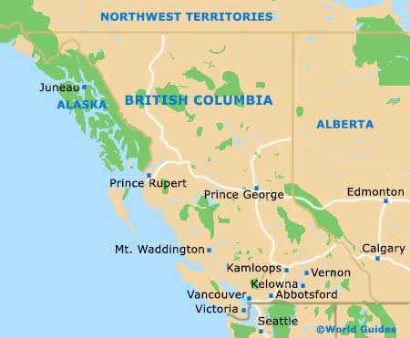
Map of Canada

Map of British Columbia
Map of Victoria